
A trail blazing hike - not that we want to!

Grand trees!
One day, I chanced on a blog about Bukit Telapa Buruk and the 'B24 Liberator wreckage' which is in the adjoining hill of Bukit Berembun. The hills is situated in Kuala Klawang which is not too far away and actually the hill can be seen from Angsi's peak and vice versa. It is just across the Kuala Pilah Highway. I researched about the trail head and anything about the trail. Most importantly the routes and way points of the trail. It was almost non-existent. So, we are going blind!

Nice! but at RM1900, I need to scarifice many lunches.
On 24thJune, Patrick wanted to test out his brand new Garmin Rino 650, so I suggested we try to hike up to the wreckage. We met in Saga Highway at 6.00am and off we went via Silk Highway to Lekas. We were chatting and missed the Lekas HIghway but no matter, there are alternate routes to Kuala Klawang. We had breakfast in Seremban and it was raining quite heavily.
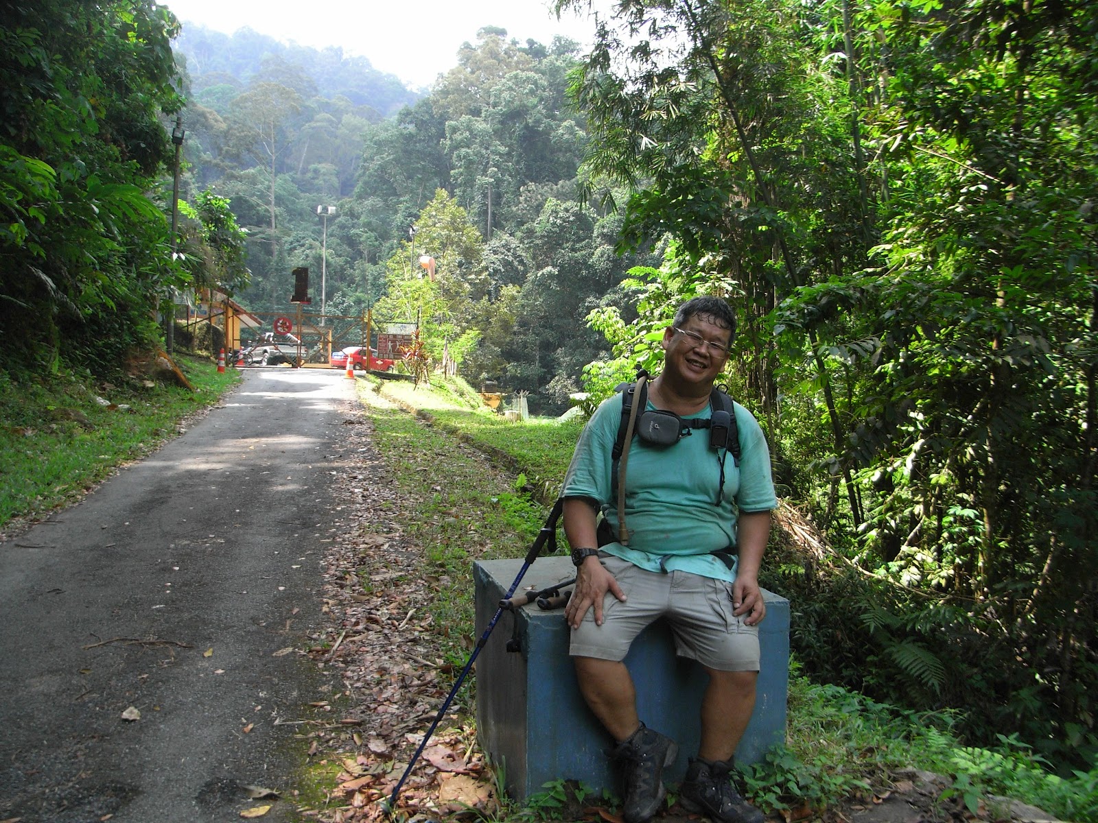
After breakfast, we drove to Kampong Pantai and soon we reached the trailhead. I was familiar as I have found out from some blogs. At the trailhead is the Pantai water treatment plant and there was a worker there and I asked him if the trail to Berembun is there. He confirmed but the hike to the wreckage will take 8 hours averagely! I was stunned and was not prepared for this so we settled for Berembun's peak.

The trail head.
So, no guide, no experienced hiker, no coordinates just a confirmed trail head, we started up the trail. After a while, we came to a junction and we pondered which was the one. We took the easy one and as it continues, the trail was not maintain at all. At certain points, it was impassable. we took the hard upward way on the right. Now, there are no trails, just a heading for the peak. After much difficulty, we met a another trail after 150 meters elevation gain. We followed it but it also became obscure after a 20 minutes. So, we were zig zagging all over the hill as there were no trails. The hills has some of the most beautiful untouched trees I have seen but between them, there was also plenty of those spiky palm trees. My clothings were jagged and my backpack was too. Leeches was having a feast too! Patrick was not spared either.
I discovered that my camera was not hanging on my backpack. I told Patrick that and I backtracked to look for it. I was searching and seaching , back tracking all the way 100 meters down. That's elevation not distance! I still can't locate it. I gave up and hike up again, all over again. Just as I was going up the last slope, I saw it. I pick it up, dusted it and continued on. I shouted to Patrick that I found it as he was helping to look for it too.
We kept going up and up and then a check with the GPS proved we were not making progress at all. We then headed East which was the straight heading to the peak and this prove to be an agonising hike! Obstacle, go around it, fallen logs, climb over it. We have to trek very carefully too as it was steep and also the fallen leaves was so thick making treading it tedious. We started at 8.20am and it was now 11.30am and there was no distinct trails.

The agar wood tree. The sap flowing out was burned!
The heading took us to a large rock formation and my guess was this could be Gua Kambing's top. We headed down to try to circumnavigate around the rock to find an opening but there was none. Disappointingly, this was not the 'Gua Kambing'. It was a dead end too as we cannot find a way round the boulders so we can only go down. Then we can hear river flowing and we headed down the valley. Somewhere here we found a trail, very distinct so we followed it. Just before the river, the trail was fading too but we continued down the river. It was peaceful there, only two of us and so we took a breather.

Nice and clean river.
Across the river, there was also a steep climb but no trails were seen. GPS reading says the peak is to the South East. We trekked up all the way up and try to locate any trails at all, but there was none. Probably, the trails didn't come so high up yet. It was 540 meters before we stopped and the peak was supposed to be 682 meters. We hiked at the constant elevation but it was not easy as the fallen leaves was thick and the spiky palms was aplenty! Again, we come to a rock and I saw a bald patch there, so I sat down and rested. It was already 12.30 pm now and the peak looks so far in the GPS.
We decided to head down and so we back tracked through our GPS. Somehow or rather we always can't recognise the trail although we passed just a few hours ago. we seem to side tracked a bit and then intersect our original path and then back to the original route again. Somewhere here, I fell and sprained my wrist and also my neck was aching. This is not good at all! Slowly and painfully, I trekked down to the river again with the use of only one hand. I nearly fell many times but we reached the river again. We had lunch here and I drank a lot of water here. Putting on the backpack also has become an effort.

It is already 1.20pm now but we should have enough daylight time to head out again. we were quite prepared too and water was not a problem in this hill, plenty of it. My wrist was still painful after a rubbing of analgelsic cream but as they have said before, " Going back is mandatory! " After finding and losing the original trail we hiked this morning, a check with the GPS shows that the car park was just less than a kilometre away but a steep downhill and no trails at all, just densely protruding trees shadowing the spiky palms and sea of fallen leaves all over.
Thinking about my paining wrist, I then ask Patrick to barge through the woods downhill. That's the fastest way out. It was steep and I was without the use of one hand so it was harder for me than Patrick. The car got nearer and nearer and then the original track that we hiked this morning near the starting point was beginning to merge. I told Patrick to head for the morning's trail and after 10 minutes we were at the original trail and after just another 20 minutes, we were back at the water treatment plant. I rested there for a moment while Patrick still wants to explore other trails behind the water treatment plant.
Well, I can still smile so I am still OK!
The next time, there definately will be another attempt, I will hire a 4WD to ferry me all the way to Telapa Buruk's peak and make my way down to the 'B 24 wreckage' and then to Berembun's peak and out via this trail again. Hopefully, it won't be too far away. As I can see, not many hikers hikes here, there were not even a single marker at the hill, not even one! The trees here was really majestic! I never seen many large trees in one hike.
We drove to Seremban to feast ourself at Yee Kee's Beef Noodles. I took the large one too and I 'walloped' it like a hungry beggar. Don't ask me if it is nice because I don't know! LOL.

Too hungry to know if it is nice or not!
No comments:
Post a Comment