Search This Blog

Sunday, July 1, 2012


Bukit Berembun or Is it Berembun?


                                         One of the nice falls we encountered.

Weekend is coming again and my wrist is still in pain. Patrick was suggesting simpler hikes as my wrist was still healing from last week's fall. I replied, " Why not try to finish what we started last week." He answered, " I am all for it!." I think my wrist is manageble, so I thought!

                                             Patrick and Bella looking fresh.

So, same place same time as last week. This time, we have Bella to join us on our exploratory hike. My car broke down at the last minute, so I have to walk to the designated meeting place. It's not so far from my home. At 5.30am I started from my home with a backpack, another bag filled with my hiking shoes and a camera bag with a hiking pole dangling from somewhere. I was apprehensive whenever I saw motorcycles passing but I was facing the traffic. Sigh............... such is living in KL. They were already there when I reached the 11th mile toll plaza so I hopped in and off we go via the 'Lekas' highway.

Patrick and me looking really fresh.

We went to the same 'mamak' shop in Seremban that we patronised last week. We then proceeded to the trail head in Pantai after that. It was only 7.00am then. Without any further delay we put on our hiking shoes and backpacks, switched on the GPS and off we went. We went into a branching trail that we didn't do last week and further on I saw that the trail on this path was more clearer. I also noticed the trail follows the meandering river. It was not steep and the hike was pleasant but there were many fallen logs to clamber over or go under. Some is so big and with my hurtful wrist, I can't go over it but to take off my backpack and go under on all fours.


The forest here was really virgin as mentioned on the notice boards and I mean really virgin. There are no plastic markers tied to trees and no paper trails, just thick carpet of fallen dried leaves which means leeches! After an hour we can hear loud gushing of waterfall and detoured into a smaller trail which leads us to the waterfall. It was nice and refreshing. We took a few snaps and made our way back to the main trail. The trail was still meandering along the river banks. Many times the trail detours around obstacles like fallen trees. After 2 hours hike we came to the end of this trail with a large rock blocking the path. We were still near the river. Patrick clambered up the slope beside the boulder while I and Bella watched.

                                              Wonderful trail

I then noticed an assembly of rock. Three rocks to be exact, one atop each other. A few metres towards the river is another formation which means we have to cross the river. We hollered for Patrick to return and we cross the river afterwards. We looked for signs of trails after crossing but didn't see any. So, We went up the slope and we saw another trail there. On the right was a big fallen tree with branches fanning all over and the only visible trail we saw was to the right. We hiked for 30 minutes before I felt it was not right. We were hiking with the flow of the river while we should be doing the opposite, againts the flow. I checked my GPS and call them to regroup. I told them we are hiking back to our original position and we should go back to the river crossing. They didn't objected so we hiked back to our original position. As we proceeded, I felt some stinging in my abdomen. I told them to carry on and and when they went out of sight, I took off my pants and undies. There it was! The little rascal was among the hairs. I pulled it out and threw it into the bush. It was hitching a free ride with meals thrown in. What a bargain! We have been practically pulling off leeches all the time since the hike started.

                                                              Relaxing at the falls. 

Back at the fallen tree we regrouped. I told Bella about the leech and she wanted to hear nothing of it. Too obscene for her. Ha,ha. Here, we either have to cross back to the other side and try another path or............ I told Patrick to see if there are other trails beyond the fallen tree. He did not see any but I asked him to climb over the trees anyway. He did as said and once there he saw another trail. So me and Bella would have to do the same too. After some effort, both of us are also over the other side.

We are hiking in the right direction now. Again, we were crossing rivers and hurdling over obstacles, dragging leeches off our limbs. There's also a part where we need to splosh through ankle deep mud, black coloured slosh! We have to do that under an arch of low growing vines and leaves. After a while still in the mud we need to go over fallen trees and this mud wading went for about 30 meters. My shoes were covered with the muck and Bella very ladylike managed to keep her socks clean. I wonder how she manages that! Patrick was practically wading through the muck but he was wearing an Adidas water shoes. So, not much problem while luckily for me I was wearing an ankle height shoes and today it has proven it water proofing capability. Bella was complaining of hunger now so we chose a nice riverbank spot and took five. I was not really hungry but I rewarded myself with the big bottle of 100Plus I carried in my backpack. This seems to be the perfect time.


The creek where we had lunch.


The inclination of the trail started to increase from here onwards but not that acute. It was still very gradual hike. There were more leeches though. As usual we were checking for leeches, spraying Mosi Guard avoiding hanging vines, climbing over fallen trees and going under them. After another hour or so, we came to a large overhanging rock, much like Bukit Kutu's but smaller. I recognised it as 'Gua Kambing' from the blogs. I can now confirm that we are on the right trail. Hooray! for that.


Patrick and myself resting in Gua Kambing.     


After resting, I told Bella and Patrick to continue on as I am giving up. I needed the rest. They urged me on and was willing to wait for me to completely rest. After half an hour, we mounted our backpacks and continued. We stone hopped over some rocks here as there a water source here. At some point, Patrick who was in front started laughing, while looking at the trail. I knew what that means and when Bella reached, she sighed ! When I saw the 60 degree inclination that leads to infinity, I gawked! After a few minutes into it, I hollered to Patrick and Bella to carry on. I am going back to 'Gua Kambing'. They discussed for a moment and after reassuring that I will be fine, they carried on. Patrick came down to get the camera from me. At least I have a picture of the peak.

While they went up, I trundled down. At 'Gua Kambing' I took out my fly sheet, no, not ground sheet but fly sheet, and laid it on the ground. I wanted to rest, whatever sheet will do! I sat on the sheet and took off my shoes. There was three fat slugs feasting on my blood. Took them out and it was bleeding. I took my first aid kit out and wash the skin puncture with Dettol and plastered it with Band Aid. Pulling the one at the rear of my left leg was hard as my wrist can't seem to be able to grip it. I then went to sleep. After an hour I woke up and there was bees and some black bugs flying all over me. There were thirsting over my sweat. I took out my lunch (cheese sandwich) and slowly munch it and gulped my 100Plus. I was enjoying my little party alone in presence of solitude! Wonderful.


At 2.30pm, I called Bella on  my hand phone. My Celcom line had a bar but Patrick's Digi is dead! Bella's Maxis rang once but she did not pick up and after a few attempts her's too went dead. I can hear thunder and dark clouds were looming past. I am worried about them and also the rain if it comes. We have cross so many rivers and if any one of them swells, we can't go back. Hiking in the dark is still OK as both me and Patrick carries torch lights but we can't do anything about river swells. Only thing we can do is pitch a tent and stay under it for the river level to subsides. That's why I have a fly sheet and cords in my back pack. Then at 3.00pm, I can hear their voices and I was relieved.

Bella at the peak after the 6 hours hike.


By the time they are down, I was already long packed up. After a few minutes rest, we started down without delay. Going down is the same story, detouring over obstacles, climbing over them, going under them but at a faster pace. Back to the sloshy part, then back to the fallen tree and cross the river. After here, I can rest assured as this is the major river crossing. We had a rest here and ate some dried fruits, dates and raisins to be exact, brought by Patrick. After a while we started back without delay and hiked as fast as we possibly able to, just to save daylight time. I was sweating profusely at this pace and my spectacles are all blurred with sweat and I can't wipe with anything as everything on me is wet. We just kept going and going and finally we reached the car park at 6.00pm. Whew! it was still daylight. Patrick went to the river to clean up while me and Bella changed into dry clothes. Then Patrick came back but we were too tired to doing anything else. Patrick was tired too, so he postphoned leaving for a while. Imagine myself, if Patrick is that tired, I can sit there all night if he wants to.


We rested for 40 minutes before we finally hopped into the car. We were hungry but nothing in Seremban really fancied us so we decided to head straight to KL for dinner. We went to a 'Yong Tow Foo' shop in Bandar Mahkota Cheras. It is a branch from one of the few famous ones in Ampang. My wife went there too to fetch me and we had a good and satisfying dinner. When Patrick stood up after the meal, there was blood all over the chair. Seems Patrick is having periods, ha,ha,ha. There was still blood suckers in his butt. The shop's waiter gave a 'yuccckish' look after seeing the chair before taking it to the back to wash.


The total distance I covered was 14 kilometers and moving time was 4 hours. So, I can presume that to do the peak, it is a 5 hour journey one way although it might just be 9 kilometers to the peak. Funny fact is, the peak was measured at 682 metres asl in the blogs but the contour maps in our GPS states the peak at within the 1000 metre line. Proof of that is Patrick recorded the peak at that height too. I was in 'Gua Kambing' which recorded 660 metres asl on my GPS while my watch recorded about the same. Did they hiked another peak?


Sunday, June 24, 2012


             A trail blazing hike - not that we want to!

                                                         Grand trees!


One day, I chanced on a blog about Bukit Telapa Buruk and the 'B24 Liberator wreckage' which is in the adjoining hill of Bukit Berembun. The hills is situated in Kuala Klawang which is not too far away and actually the hill can be seen from Angsi's peak and vice versa. It is just across the Kuala Pilah Highway. I researched about the trail head and anything about the trail. Most importantly the routes and way points of the trail. It was almost non-existent. So, we are going blind!

                              Nice! but at RM1900, I need to scarifice many lunches.

On 24thJune, Patrick wanted to test out his brand new Garmin Rino 650, so I suggested we try to hike up to the wreckage. We met in Saga Highway at 6.00am and off we went via Silk Highway to Lekas. We were chatting and missed the Lekas HIghway but no matter, there are alternate routes to Kuala Klawang. We had breakfast in Seremban and it was raining quite heavily.

After breakfast, we drove to Kampong Pantai and soon we reached the trailhead. I was familiar as I have found out from some blogs. At the trailhead is the Pantai water treatment plant and there was a worker there and I asked him if the trail to Berembun is there. He confirmed but the hike to the wreckage will take 8 hours averagely! I was stunned and was not prepared for this so we settled for Berembun's peak.

                                                        The trail head.

So, no guide, no experienced hiker, no coordinates just a confirmed trail head, we started up the trail. After a  while, we came to a junction and we pondered which was the one. We took the easy one and as it continues, the trail was not maintain at all. At certain points, it was impassable. we took the hard upward way on the right. Now, there are no trails, just a heading for the peak. After much difficulty, we met a another trail after 150 meters elevation gain. We followed it but it also became obscure after a 20 minutes. So, we were zig zagging all over the hill as there were no trails. The hills has some of the most beautiful untouched trees I have seen but between them, there was also plenty of those spiky palm trees. My clothings were jagged and my backpack was too. Leeches was having a feast too! Patrick was not spared either.

I discovered that my camera was not hanging on my backpack. I told Patrick that and I backtracked to look for it. I was searching and seaching , back tracking all the way 100 meters down. That's elevation not distance! I still can't locate it. I gave up and hike up again, all over again. Just as I was going up the last slope, I saw it. I pick it up, dusted it and continued on. I shouted to Patrick that I found it as he was helping to look for it too.

We kept going up and up and then a check with the GPS proved we were not making progress at all. We then headed East which was the straight heading to the peak and this prove to be an agonising hike! Obstacle, go around it, fallen logs, climb over it. We have to trek very carefully too as it was steep and also the fallen leaves was so thick making treading it tedious. We started at 8.20am and it was now 11.30am and there was no distinct trails.

                              The agar wood tree. The sap flowing out was burned!

The heading took us to a large rock formation and my guess was this could be Gua Kambing's top. We headed down to try to circumnavigate around the rock to find an opening but there was none. Disappointingly, this was not the 'Gua Kambing'. It was a dead end too as we cannot find a way round the boulders so we can only go down. Then we can hear river flowing and we headed down the valley. Somewhere here we found a trail, very distinct so we followed it. Just before the river, the trail was fading too but we continued down the river. It was peaceful there, only two of us and so we took a breather.

                                                   Nice and clean river.

Across the river, there was also a steep climb but no trails were seen. GPS reading says the peak is to the South East. We trekked up all the way up and try to locate any trails at all, but there was none. Probably, the trails  didn't come so high up yet. It was 540 meters before we stopped and the peak was supposed to be 682 meters. We hiked  at the constant elevation but it was not easy as the fallen leaves was thick and the spiky palms was aplenty! Again, we come to a rock and I saw a bald patch there, so I sat down and rested. It was already 12.30 pm now and the peak looks so far in the GPS.

We decided to head down and so we back tracked through our GPS. Somehow or rather we always can't recognise the trail although we passed just a few hours ago. we seem to side tracked a bit and then intersect our original path and then back to the original route again. Somewhere here, I fell and sprained my wrist and also my neck was aching. This is not good at all! Slowly and painfully, I trekked down to the river again with the use of only one hand. I nearly fell many times but we reached the river again. We had lunch here and I drank a lot of water here. Putting on the backpack also has become an effort.


                                                                  Patrick in the light!

It is already 1.20pm now but we should have enough daylight time to head out again. we were quite prepared too and water was not a problem in this hill, plenty of it. My wrist was still painful after a rubbing of analgelsic cream but as they have said before, " Going back is mandatory! " After finding and losing the original trail we hiked this morning, a check with the GPS shows that the car park was just less than a kilometre away but a steep downhill and no trails at all, just densely protruding trees shadowing the spiky palms and sea of fallen leaves all over.

Thinking about my paining wrist, I then ask Patrick to barge through the woods downhill. That's the fastest way out. It was steep and I was without the use of one hand so it was harder for me than Patrick. The car got nearer and nearer and then the original track that we hiked this morning near the starting point was beginning to merge. I told Patrick to head for the morning's trail and after 10 minutes we were at the original trail and after just another 20 minutes, we were back at the water treatment plant. I rested there for a moment while Patrick still wants to explore other trails behind the water treatment plant.

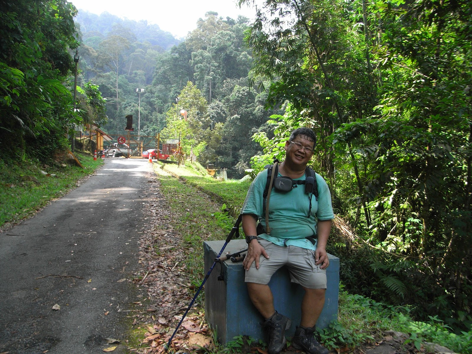
                                      Well, I can still smile so I am still OK!

The next time, there definately will be another attempt, I will hire a 4WD to ferry me all the way to Telapa Buruk's peak and make my way down to the 'B 24 wreckage' and then to Berembun's peak and out via this trail again. Hopefully, it won't be too far away. As I can see, not many hikers hikes here, there were not even a single marker at the hill, not even one! The trees here was really majestic! I never seen many large trees in one hike.

We drove to Seremban to feast ourself at Yee Kee's Beef Noodles. I took the large one too and I 'walloped' it like a hungry beggar. Don't ask me if it is nice because I don't know! LOL.

                                     Too hungry to know if it is nice or not!

Sunday, June 17, 2012


Bukit Kutu Revisited. "Ascending is an option but descending is mandatory!"


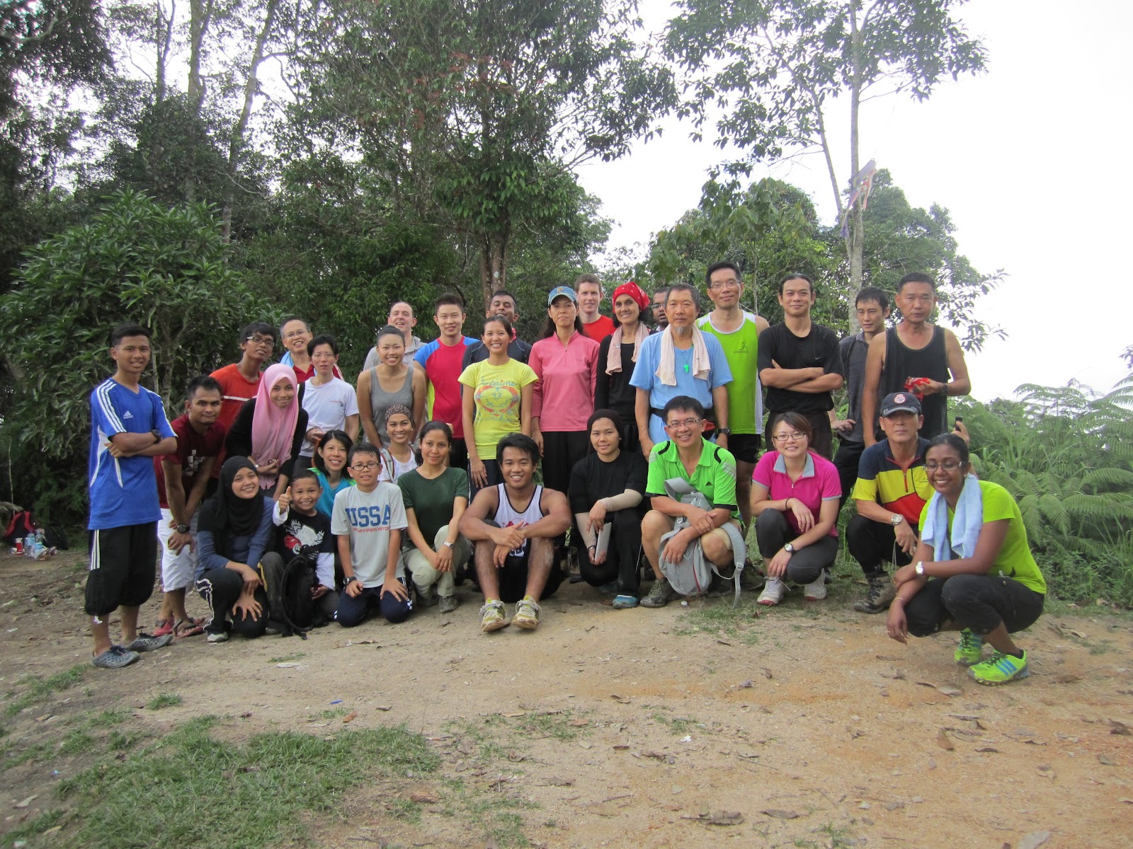
                       Group photo at the chimney stack, quite standard for Bukit Kutu.


I got an invitation from Raymond for a hike to Bukit Kutu and I acccepted the invite and I pulled in Lilian for the hike too. The last time we hiked up was on the first day of Chinese New year (can you belief how bored we were during the festivities!). The former trip was organised by Alex KL Hiking. It was quite tough for me then and it's about time for me to really gauge if I have improved.

As I have to pick up my daughter from work right after the hike, I did not offer any car pooling for this time. Bella was not able to make it and Patrick has to work Saturdays. The last hike in Angsi made me make an effort to wake up earlier so I can have a proper breakfast. I have informed Raymond that I will make my way to the trail head myself.

                             Contrary to most says, the big rock is actually quite 
                                                 a distance to the peak!

I reached Kuala Kubu Baru (KKB) at 7.00am but the intended Hainanese coffee shop was still not opened. The shutters were partially opened but the young chap closed it tighter the moment my car was parked in front of it. So, me and Lilian went opposite for 'mamak' breakie. On the tables were 'nasi lemak bungkus', my favourite actually. I had a slow and leisurely breakfast, no rush and I was at Pertak trail head at exactly 7.45am as I promised. I was the first there but I had a good chat with one Encik Saiful from Putrajaya. In fact they were the group that has carried aluminium ladders to replace the rickety wood ladders at the summit. 'Thank you' to them for the effort. He also mentioned that another old trail has been found. The old trail from Ampang Pecah (the old Kuala Kubu before flood destroyed the town) and they will be doing a hike on the old trail after the coming Hari Raya. I immedietely got hold of his contact and wanted to join the hike. He explained that it will not be disclosed yet and somewhere in the forest, an old locomotive was also found. There was a railway line here to ferry natural resources from Pahang to the Port town on the west coast. This was the only way to the east coast then as there were no Karak highway then. To safeguard the find from 'besi buruk' dealers, it will be kept secret for the mean time. The idea of a 'trans Bukit Kutu hike' is exciting, meaning ascending from Pertak and descending in Ampang Pecah. Off course, the logistics must be arranged but the distance is short so it's not that hard.


                                               The 'Gates' to Bukit Kutu.

Back to the hike, the rest arrived shortly after 8.00am and by the time we started, it was already 8.30am. "You know me lah!" I always take the last place. Easier to take a pee and also fart if I need to. "What to do, old liao!" They were all there at the river crossing which I listed as Riv 2 on the chart. I really hate taking off and putting on the shoes back. I can barely stand on two legs let alone one! I must order a hiking shoes from Hitec that stretches to the thighs. So, I don't have to take off my shoes for river crossings like these. Mine now is only water proofed to the ankles.

                                                   River crossing at RIV2

We hike passed durian orchards and suprisingly, there were some fallen ones and at the first hike in January, there were also in season. Since when is durians available all year round from the same orchard. As me and Lilian slowly trekked up, I met Raymond sweeping two new hikers. One of them was nearly blacked out! He wanted to turn back but Raymond won't allow it and I too persuaded him to take a long rest. I offered some rehydrating salt to him and also some balm for his dizziness. So, the 5 of us were trekking at a very slow pace to accommodate him. We just want to make sure he make it. Usually if they are no coaxing and if he returned, this new hiker will definitely not hike any more!

                              Trekking into orang asli's orchard where they have put
                                           up a notice warning barring hikers!

At 'Checkpoint 5', the front group was not there anymore. They have all move up. We took our time though as I too like a slow trek. After a satisfying rest, we continued and the pace seems to quicken from here onwards. The newbie was actually hiking faster than me and Lilian. After 'checkpoint 7', Raymond shoot off first. It doesn't matter as I can sweep and furthermore the two newbies was in fact hiking faster than me and Lilian. Although they were faster they did wait up and rest too and they were always within sight. The trail was cleaned up and direction signs posted everywhere and hard trails were blocked and easier trails retained even though they are longer. I heard the Fire Department is responsible for this.

                         Our friend nearly gave up! In the beginning he was hiking at a 
                                wrong pace. Luckily we have Raymond as organizer.

I reached the top and they were all resting at the peak just below the boulder. Just the same as the last, I did not climb the boulder as there is a bad haze around, so there are no views. Raymond looked at me and Lilian and asked us, Where are the two new hikers?" I answered, "They were in front of us". They must have took a wrong turn but the trail leads to the same point. Just about that time, they appeared amid cheers from the group.

                               All enjoying resto-ology until some fitter than most 
                                                      wanted to run.

A few minutes later another part of the group appeared, they were visiting the old sanatorium. Then Victor asked, "Where's KT.Wong?" I raised my hand and said, "Here!" I thanked Victor for his concern but I was not the last one up this time, heh,heh,heh! 10 minutes later, Madam Yoga urged all to start descending. She was adamant despite protest from Raymond and honestly I was protesting too. Then she used the cloudy skies as a good reason to descend. I was wondering how she sees thorough the haze. Yee and some others said there were no group photo yet. We all then agreed to have the group photo at the chimney stack.

                                           What's left of the old sanatorium!

There was a photography enthusiast that was still atop the rock and he too, I suspect is not really keen to descend yet! At times I cannot fathom the logic that some hikers have. Why do they take 3 hours to ascend but wants to descend the moment they reach? What's the hurry? I can understand those that needs to be somewhere at a certain time but those not doing anything, I am puzzled. Hiking with Raymond is great, to me though. No hurries, no time constraint, in fact I think that's what hiking outings should be. Why do people wants to keep chasing time? Isn't doing that 6 days a week not enough? Why want to pursue time even when you are trying to enjoy doing something you like. I suspect those chasing time are not there to enjoy, they must have some other agenda or their biological clock is ticking at the same rate. There are many hikers who likes photography, some likes nature, some like botany, some likes mineralogy and myself, I just love REST-ology also known as replenishinology. I known some like runninology but at least try to give and take as we are a group, I dare say all have different attitudes towards hiking.

                                       What's left of the old colonial bungalow.

Slowly one by one, we all trudged down. I was the last with Lilian in tow or rather Lilian had me in tow. Half an hour into descent, I met Saiful again with three hikers in tow. We chatted a while and wished each other goodbye. At 'checkpoint 5', the big rock, I saw a group resting there and since there was no place for me to rest, I continued descending. I thought of having a bite and rest. All along the trail from 'checkpoint 5' to 'checkpoint 4', the trail was literally full of hikers lying down, sleeping, resting, sighing, cursing etc. Then I saw one more appropriately attired for the hike. I enquired," Siapa organise ni?" He answered proudly, "Sayalah". Then I told him, "You mesti kena marah kau-kau punya kat atas. He queried, "Kenapa?" "Banyak dah pancit tengah jalan,"I answered. He was chuckling and then we bade goodbyes.

Further on down, I met another 2 organisers of the group. I chatted with them and they told me they are from the Sunway Group and there were 50 of them. They plan to camp at the peak for the night. We chatted and joke for a good 10 minutes before I continued. He told me of a 'running auntie' in green T-shirt. "That must be the 'Madam Yoga", I said. I told them, " Mungkin dia lapar kot!" I think Bukit Kutu is not suitable for a social event of an organisation. A waterfall somewhere is more appropriate. Some have never hiked before and I noticed there were 4 with soles of their shoes wrapped with duct tape. Some of them will surely remember this outing for life!

When I reach the orchard area, I took a durian and using my folding knife, I pry open one. It was raw and I spilled blood doing it. It must be raining or windy last night. The fruit don't fall unless it is ripe and this must have been blown off from the branches. I saw part of the group drenching themselves in the river and since we are near to the car park, I didn't bother to take off my shoes. Same with Lilian, we trudged into the river with the shoes. I waited a while for them to get ready and off we go again. Usually my mind is weak here. Just like the logging trail in Nuang and Rajah, we are anticipating the trek to end. The trail seems to go on and on. Finally the first bridge and then the second.

I had lunch with Raymond at the same venue as the time we went Ulu Semangkok the last trip. We wanted to try out a good spot that was mentioned in one of the dailies but it was closed. They closed at 3.00pm but it was already 4.00pm. We had our meal and then we went off our separate way. I decided to take Ulu Yam route this time back as Rawang was always jam just like the many times I experienced and today is Saturday and not Sunday. I reached KLCC at 6.15pm and there was another 45 minutes before my daughter finish work. In our dirty garb and sweat smelled bodies we bought two cups of 'Gong Cha' or literally in English 'Silly Tea' and sat at the atrium until 7.00pm. 

Conclusion, I think I have somewhat improved on my hikes but the speed cannot be improved. Mentally I have improved as I don't have shivers looking at steep inclines because I know I can hike it. I can't improve on speed though because if I try to follow the front group, I will disrupt my rhythm and breathing. This is probably due to my sinus problem and also my knees. Unlike the others, my descent takes the same time as my ascent and I can still walk around KLCC after the hike means I am better than the last time. As for speed, if some hikers want to hike fast, go ahead but I will keep my comfortable pace. If you cannot wait, please be my guest and go back first, that's why I invested in the GPS anyway. In every hike, I am always prepared to hike even till daylight runs out. Rushing is not an option!

Like a good quote I read somewhere, "Ascending is an option but descending is mandatory!", so pace ourself.

Monday, June 4, 2012


                   Gunong Angsi ( Almost lao sai! )

                          A picture I was not in as I did not reach the top...sob,sob!

I have been shuttling between hikes on those dates. First was the date that I was anticipating, Gunong Benum! The guide from Jerantut called after I have RVSPed for the Angsi hike. I have to un-RVSP myself from the hike and also I was to take charge of the guiding of day trippers from KL to Ulu Bendul, not to mention car pooling  agreement. Then, I felt it was not so nice and I then cancelled the trip on the 2nd to Benum and thought that  I can organize one on the 8th for Benum. Then there was no other hikers as the dates clashed. I cancelled that as well. What the heck! just concentrate on the Angsi hike. I then inform them and made back the former arrangements.

As pre-arranged, we all met at the Petronas station opposite Phoenix Plaza at 5.45am. Most of them was already there and later everyone arrived except for Chin. It was already 6.00 am then I have no choice but to push off! Chin arrived just at the moment when the last car departs. The convoy was uneventful as the highway was quite empty at that hour. We arrived in Ulu Bendul at 7.15am and the road leading into the Recreational Park was still closed and we have to park our cars outside.

After changing into hiking shoes we moved into the park on foot and look for the campers that was here last night. I was  a bit suprised to see there were more day trippers than campers. We met the organizer, Henry who just woke up and was a bit suprised that we were early. Henry requested Ann to collect the RM5 hiking entrance fee from every one. After the registering was done, we started off!

                              Our fellow hiker has made great strides in hiking fashion.

I was thinking that Angsi would not be a tough mountain to hike and I even invited a newbie to hike. I mean, it took  me 150 minutes the last time and that was my second hike. Although Ulu Bendul is a longer route as opposed to Bukit Putus, it would not be so hard, right? Hmmm....... actually no! I was wrong. This trail starts off easy but the long first section really saps your energy first before hitting you with a long steep climb later! More like disarming you first before the fight.

As usual, I always hike at the back. I don't really like hikers at my back as I like to take my time hiking. Jeffrey (the newbie I invited) was with me. At this stage Lilian and Mabel was also hiking at my pace or rather at Jeffrey's pace. I kept looking at my GPS and we were actually hiking in a gorge beside the river with not much gain in elevation. We were already hiking 70 minutes and my altimeter is showing only 300 meters. This is suprising! Another check with my GPS with the contour map enlarged showed me a disaster that was coming. The 500 meters mark in the contour map is brown and we are still hiking at the beige section which was below the 500 meters. There's still a kilometer or so to the brown markings! Jeffrey has already started to show tiredness.

                                          Hiking seems effortless to them!

Just a few hundred meters before the 500 meters mark, we met Chin Lip Kee sitting on the 'Lazy Log 1'. Then the rumble in my mind started. Should I wait for Chin? Should I stay back with him? Then, I moved on since Chin is an experienced hiker. I urged Jeffrey on and at the same time I told Lilian and Mabel to proceed. Jeffrey will take some time and will slow them down. So, I took a bottle of 100 Plus in my pocket and urged them on. I lost sight of them in just a few minutes.

                                  Pull, pull and don't let go till you reach the top!

I let Jeffrey take a breather after every few hundred meters as his heart rate accelerates very fast if pushed  too hard. We reached the 500 meters point as indicated on the GPS. Then I saw this long infinite steps that was created by the roots of the trees. It was wide, Yes! But the steps kept going up and up and I can't see the end! The guy that trail blazed the trail must have been a rhinocheros! He didn't make a more subtle and winding trails. He just bulldozed up in a straight line to the top. It was like hiking an Inca pyramid. Jeffrey got cold feet looking at the steps. I told him to take a few steps at a time. I made target markers to reach. "Let's make our way to that big tree", I would encourage. Then,"Let's take a few more steps to that fallen log". Slowly we made to the top (not the peak but only further up) and that's where we met Chin Senor (Chin Lip Kee's partner). He was squatting on the top of a pinnacle with his staff between his legs, staring at me. He looks like the apparition that I saw in 'river Y'. Luckily it was daytime and he was attired in orange.

You have to pull yourself up with the ropes anchored there. There was 3 sections. With Chin Senor's guidance, we managed to pull ourselves up to the first section (that's where Chin Senor was squatting at). He enquired about Chin Lip Kee. I told him Chin Lip Kee is already 'pancit' (punctured in English) at the lazy log. He asked, "Is he coming up?" " I doubt so!", I replied. At this time Jeffrey exclaimed," Wah! there's more slopes to climb". There was another slope which needs ropes to reach. Jeffrey lamented that this rope climbing is really sapping his energy. I have to agree with him. Chin Senor decided to follows us after I told him that there's a short cut down from  the top. Actually I was thinking of descending via the Bukit Putus trail and ask Lilian to pick us up there.

It was a good plan. You reach the peak and you also take a shorter route down. It's a win win solution, right? As we moved higher and higher, Jeffrey's rest time was getting more frequent. It also shows in him. I was getting very tired too! My 100 Plus was depleted and there was no time for breakfast that morning. My lunch was with Lilian at the top. Slowly we inched upwards and the thought of resting longer at the peak was Jeffrey's mirage. We met some hikers coming down and Chin Senor asked them," Berapa lama lagi?" They answered " satu jam lagi ". "Wah! satu jam lagi", he exclaimed. Then another few hikers came down and this time Jeffrey enquired, "Jauh lagi kah?" The youngster replied, "Tak jauh, 15 minit saja". Now which is which? 15 minutes or 1 hour? Chin senor was instigating us to head down. I then ask Jeffrey's opinion, considering the short cut from the peak.

A chinese proverb says, "taking off your pants when farting!"
It means there's no need to do so!

Just before we make a decision, Jessy show up. She informed me that Lilian asked me head down. They will be coming down. I thanked Jessy but still decided to head up. The after 20 more minutes, Jeffrey stopped and I checked my GPS and it showed the peak was only 500 meters ahead! Jeffrey rested longer here and there was this last trail of steps which was very steep. I urged Jeffrey, "last ascend'.

Before we can start again, hordes of hikers from our group showed up. They were all descending at a fast pace. Chin Senor then saw Lilian and Mabel among the pack and before I can say anything, he has already joined the descending pack. First was Bella, then Patrick saw me. Patrick offered me his 100 Plus when he saw I finished mine. It was refreshing. I was thirsty since the last 30 minutes. Lilian reached me and she advised me to head down also. She says the last ascend was really steep. So, all of us headed down. Henry, being the sweeper also showed up later.

                                   Elephants don't do slopes! But this one does.

We then have to clamber down the rope slopes. It took almost 25 minutes to wait for all 7 to reach the base! The base of that particular pinnacle, I mean, not the mountain. The steep slopes has already beginning to strain my knees. 
Although Henry was kind, it was kind of pressuring to hike down fast. Luckily we were following Jeffrey's pace. It was along ardous descend for me, Jeffrey and also my daughter Mabel. It was an agonising descend, painful to the knees. I saw both Chins at a rest stop, slumbering away!

                              Father of the year award from me. Nadza and his kids.

At some point, I met Nadza and his kids. It was already half a year ago, I last saw him in Gunong Rajah. It was nice meeting him again and also I am really fascinated to see father and son bondage that close. We were almost descending together and we even rested at a stream crossing. There were fishes swimming in the stream. I was drinking from the river before Henry gave us some water purification tablet. We filled our bladder with water. After resting, we carried on and on and on and on........................

                                   Fishes in the stream! Hard to see them in KL.

We then saw the electrical poles that was near the beginning of the trails. It was kind of motivating to see the poles. It shows that we are near. Then another and then we finally see colored roofs of some buildings. Finally,we saw Bella and some others sitting there. I immedietely took off my shoes upon reaching as I did not cut my toe nails which I was contemplating on doing a few days ago. My toes was in pain also! This is the punishment for procastinating! There was no parking space, else I would ask Lilian to drive the car in.

Slowly barefooted, I trudged slowly to the car park ourside with Mabel also in the same predicament. At the stalls near the car, I walloped 2 bottles of soya bean milk. I still did not have lunch yet! I did not even take breakfast and my plan for lunch did not materialised because all the others were descending even before I can reach the top. Punishment, NO LUNCH! There was no suitable food sold there so EC Chan, Bella, Patrick, Lilian, Mabel and me decided to have lunch in Seremban. Albeit a very very late  lunch and a very,very,very,very late brunch for me. We had the famous Hakka noodle in Seremban although many always thought Seremban only has famous beef noodles. We had a laugh over the meal, chatting about the hike. After that,we made our separate ways and till the next hike! Regardless, it was fun for me except now, I need to rest my ankles and knees, AGAIN !


                          Should have continued to the peak, look how much shorter 
                                               the Bukit Putus trail is.

Sunday, May 20, 2012


Ulu Semangkok and Sepinggan!

From Left ; front row, Ima, Lilian, Anne, Nurul's guest, Patrick
back row, KT.Wong, Chin, Victor, Kim, Bella, Alana, Farisha and Mr. Chul

The thought of not making it to the peak last month was still hovering at the back of my mind and since the ankle was doing OK the on another simpler hike was not that bad, I decided to give US (Ulu Semangkok) another go. I could do it together with Lilian or I can announce it in KL Meeting. I did the latter.

Although 21 hikers RSVPed a few can't make it but we still have 16 hikers. I met them at the Rawang toll booth and those that attended was on time. I waited for another 15 minutes to see if there are others. We convoyed in 5 cars before Ima and Kim joined in from Serendah. The drive was pleasant as there was not much traffic and by 7.20 am we were at the trail head at Gap Resthouse.We parked our cars at the dilapidated car park and put on our gears.

                                   The car park with Gap Resthouse at the rear.

Chin KF arrived from Raub a short while later and so did Victor. Raymond and Chee was not here yet. They went for breakfast at KKB and they should have been here first. It was already 8.00am and upon ushering by other hikers, we started the hike and proceeded to the trail head which was just beside the road. As usual Bella took the lead and I was the last to start. 10 minutes into the hike Raymond called and I directed him to the trail head but he can't locate it. I told him to hang on while I made my back to the car park. I told Lilian to stay put and I went down. The trail head is actually a small opening on the side of the road, quite hidden actually. 20 minutes later we rejoined Lilian and proceeded. The front group was already 25 minutes ahead by now.

                                                     The hidden trail head.

Problem with myself is, if I hike on a fast pace, I loose steam very fast. We were trying to catch up the front group. Although Gunong Gap is 1183 meters and we started the hike at approximately 850 meters, difference is slightly less than 400 meters, the distance is only one kilometer. That's steep and the ancient Bedford bus engine inside me can't really run fast. I overheated at the Gap! It took us just 40 minutes to reach Gap! The rest were already on the way to the second peak. Chee managed to rejoin the first pack.

                                                    Climb, climb, climb!

The second leg of the hike was actually hiking on the ridge between two mountains. There was a few slopes and also gulleys but it was not that hard. Thing is the engine has already overheated and the improper sleep the past few weeks due to new enviroment ( I moved house ) starts to take toll on me and Lilian. Raymond was already far ahead. Me and Lilian finally reached the point where our first hike ended. There's a gulley here where you have to descend before ascending the last slope. I will call this gully "Bang Gulley". Remind me to make a sign board the next time we hike there again.

Just before reaching the gulley, there were 'monkey hollering' between Anne and Lilian and we know we were near. Anne also gave Lilian a blood crunching scream when she reached the peak. The others will be wondering what has happened but for myself, I know it's usual.Ha,ha,ha. We made it to the peak at 11.15 am and Anne said I was 15 minutes early. She expected me to reach at 11.30 am. To me that's a compliment. It started to drizzle and we were all huddling under the 'beirut' and after photo session I suggested that we descend back to the clearing (there was a small clearing on the way up).There were also lots of bees attracted to our sweat.

                                                            The summit !

The cycle starts again, by this time, my ankle pain recurred again. Seems it doesn't go away. I sprained it when I was doing 'Rajah' and I thought it healed. The pain only hibernate. It seems the descend was even more taxing. With my right ankle in pain, the load on the other foot was also paining. Luckily I brought my hiking pole. At least that helps a bit. When Lilian and me reached the 'clearing' Raymond, Chee was cooking their noodles. Patrick was lying down. Ima was sitting there with Kim and Bella was fidgetting with her bag. The rest was already on the way back as they were hungry and they did not bring lunch.

I can't really eat eventhough I was hungry and like an overheated engine, I was gulping water. My radiator was bottomless! I even took Bella's water. When they had finished lunch, if we can call it lunch, ha,ha,ha.I was bloating! We descended and somewhere between Gap and the car park I overheated again! My legs in pain, stomach bloated but still craves for water. My mind was already hallucinating about sweet soda, iced cooled soda! The tree trunks looked like Coke bottle!


The pain made me very careful on the slippery and steep slopes and this really made me and Lilian slow. The condition we were in was a factor. Usually Lilian was faster and fitter than I am but this trip she was like me too, lethargic. I think we were not in our best form. This made me think about the coming 4 days Benum hike. I was thinking of cancelling it. Since I already can contact Chin KF who stays in Raub, we can arrange Benum anytime.

By the time I reached the car park, most has left and Raymond, Chee, Bella, Lilian and myself made our way to KKB for lunch, real lunch as they were all famished. We hunt around KKB and saw one particular coffee shop with lots of patrons. They serve noodles but there was also ready fried noodles. We sat and ate there for past an hour and the cooling herbal tea was a relieve for me, at least! Anne called me informing me she was safe at home and also the jam at PLUS and also enquiring about her car pooler. I told her everything was OK as she went back with Nurul.

                                       See anne, already kangkang at the base!

All in all, I barely spoke to the hikers as we only spent 15 minutes on the peak and also 15 minutes at the car park and even that, we were all busy preparing for the hike. Partly my fault too as I was slow and spent  most of the time on the trail, lagging behind, ha,ha,ha. So, fellow hikers although there was not much  interaction, this can actually be the start of better hikes and camping trips, since the ice has broke!

After the meal, we drove back to KL and I just drove slowly and even stopping in Serendah for MORE water. Sorry we can't replace the radiator as it is already out of production.